
HGS RESEARCH HIGHLIGHT – Reactive transport modelling of acid mine drainage within discretely fractured porous media: Plume evolution from a surface source zone
This paper investigates the fate and transport of acid mine drainage (AMD) through fractured porous media using a discrete fracture network (DFN) modelling approach. This research addresses a critical environmental challenge in mining regions— predicting how acidic contaminants generated by sulphide mineral oxidation migrate through complex geological formations and interact with host rocks over time.

Manitoba Cooperator - Farm climate adaptation on tap with MFGA project
The Manitoba Co-operator has featured the latest MFGA initiative, with comments from Dr. Steve Frey, Aquanty’s Director of Research Services, highlighting how advanced modelling is supporting more climate-resilient farming in Manitoba. The new project “Evaluating climate change impacts on Manitoba’s forage and grassland landscapes” will build on the MFGA Aquanty hydrologic model to simulate how changing climate conditions could impact water availability, land use, and agricultural sustainability across the Pembina Valley and Assiniboine West Watershed Districts.

HGS RESEARCH HIGHLIGHT – Modeling fate and transport of E. coli in a small watershed with grazing lands around a pond
This research investigates the fate and transport of E. coli in a small watershed with grazing lands surrounding a pond, using HydroGeoSphere (HGS) to develop a mechanistic numerical model. Understanding how E. coli moves through surface and subsurface water systems is crucial for managing microbial contamination risks in agricultural watersheds, where livestock activities can significantly impact water quality.

HGS RESEARCH HIGHLIGHT – Monetizing the role of water in sustaining watershed ecosystem services using a fully integrated subsurface–surface water model
This research, co-authored by David R. Lapen, Susan Preston, Tariq Aziz, and Steven K. Frey, highlights the role of subsurface water in sustaining ecosystem services during droughts. Using HydroGeoSphere (HGS), the team analyzed the South Nation Watershed (SNW) in eastern Ontario, emphasizing how subsurface water supports evapotranspiration in agricultural landscapes.

HGS RESEARCH HIGHLIGHT – Numerical analysis of thermal response tests with groundwater flow and heat transfer model
This research, co-authored by J. Raymond, L. Gosselin, R. Lefebvre, and Aquanty’s René Therrien, explores how thermal response tests (TRTs) can be enhanced by employing HydroGeoSphere (HGS), our advanced modelling platform, to simulate coupled groundwater flow and heat transfer processes under complex geological settings. The study investigates the limitations of traditional line-source models, particularly in heterogeneous subsurface conditions, and introduces a numerical modelling approach to improve the accuracy of TRT analyses.

Staff Research Highlight - Spatiotemporal estimation of groundwater and surface water conditions by integrating deep learning and physics-based watershed models
We’re pleased to highlight this publication, co-authored by Aquanty’s senior scientist, Hyoun-Tae Hwang, which focuses on the integration of deep learning (DL) models with physics-based hydrological models to enhance the efficiency of estimating spatiotemporal groundwater and surface water conditions.

Staff Research Highlight - Effects of soil heterogeneity and preferential flow on the water flow and isotope transport in an experimental hillslope
We’re pleased to highlight this publication, co-authored by Aquanty’s senior scientist, Hyoun-Tae Hwang, which examines the water sources and threshold behaviours of streamflow generation in a mountain headwater catchment.

HGS RESEARCH HIGHLIGHT – The HypoSalar project: Integrating hyporheic exchange fluxes into Atlantic salmon (Salmo salar) spawning habitat models
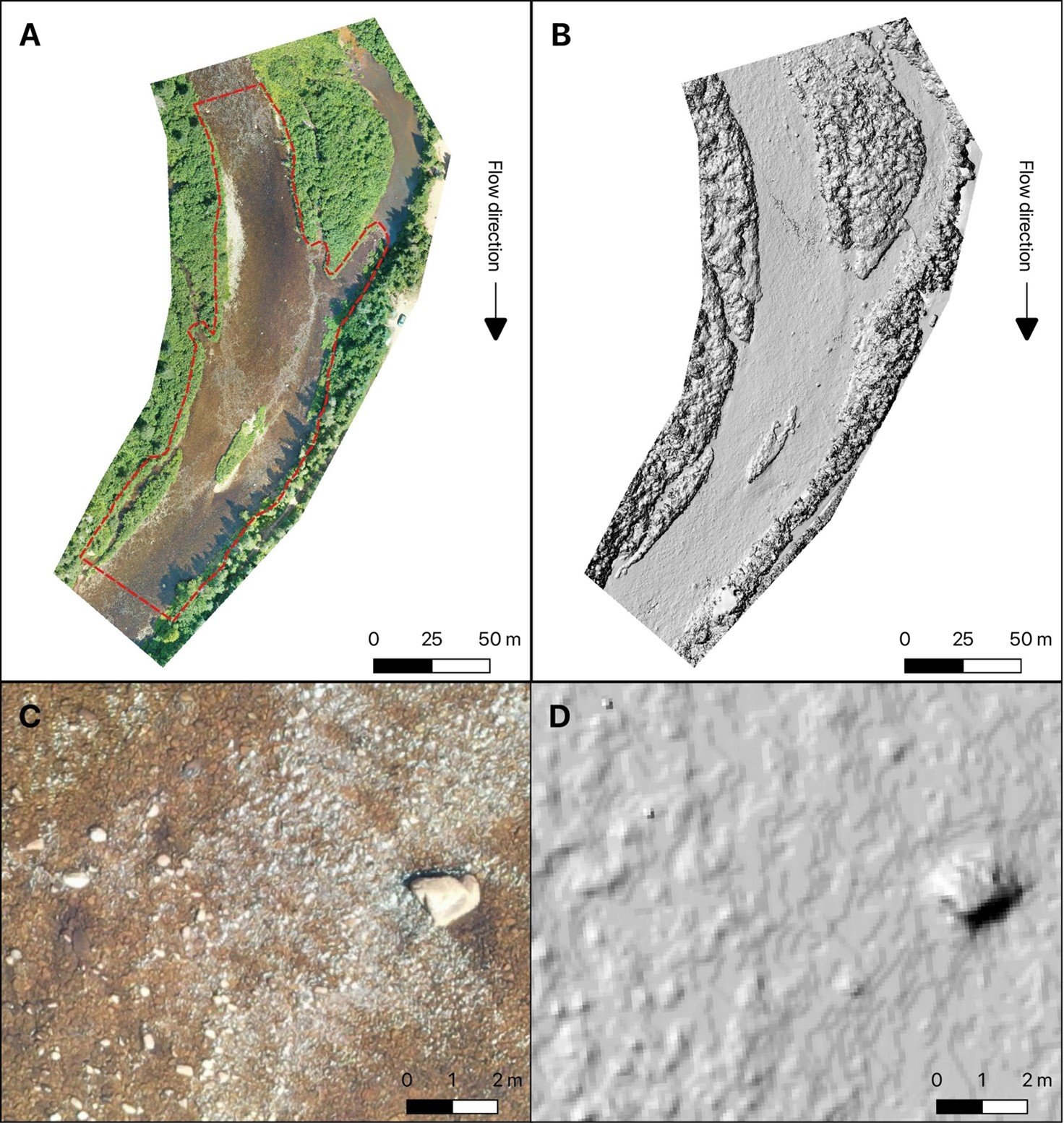
In this research highlight ultra-fine resolution HydroGeoSphere models are used to simulate hyporheic exchange fluxes in river reaches used by Atlantic salmon for spawning. The HypoSalar project is contributing to demonstrate that the capabilities of HydroGeoSphere are not exclusively related to the field of hydrogeology, but can be used for both fluvial geomorphology and ecological studies due to HydroGeoSphere's flexibility and superior modeling approach.

HGS HIGHLIGHT – Estimating cumulative wastewater treatment plant discharge influences on acesulfame and Escherichia coli in a highly impacted watershed with a fully-integrated modelling approach
In this research highlight, researchers used HydroGeoSphere (HGS) to explore the impact of wastewater treatment plant (WWTP) discharge on surface water contamination in a mixed-use watershed in Ontario, Canada. The study focused on tracking acesulfame, a commonly used artificial sweetener, and Escherichia coli (E. coli), a fecal indicator, to understand how these contaminants move between surface and groundwater systems. Understanding the interactions between surface water and groundwater is critical in watersheds where WWTP discharge contributes to regional water quality concerns.

HGS RESEARCH HIGHLIGHT – Improving control of contamination from waste rock piles
This study conducted by researchers investigates how well compacted cover layers on waste rock piles can mitigate infiltration into these waste piles, reducing the overall potential for oxidation of sulfidic waste materials and control environmental contamination. The research provides a detailed examination of how different cover configurations and hydrogeological conditions affect the performance of these covers in mitigating risks associated with waste rock piles.
