

Physics-based hydrologic forecasting of any watershed in near-real-time
An advanced cloud-based computing system that effortlessly integrates near-real-time field observations and remote sensing products with the latest meteorological predictions to produce dependable hydrological forecasts.

HGSRT: Hydrologic forecasting powered by HydroGeoSphere™
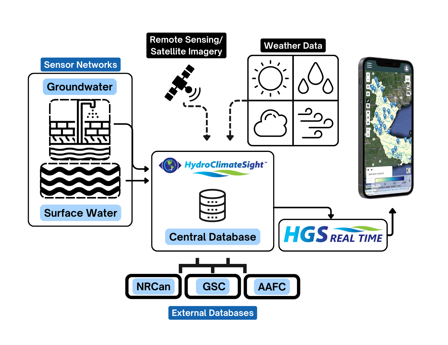
HydroGeoSphere RealTime (HGSRT) offers fully integrated hydrologic modelling as a service, delivering a near-real-time representation of a watershed for water resources decision support. Coupling of daily hydrologic forecasts with a wide-range of real-world monitoring/observation data and remote sensing data products provides a comprehensive global perspective of hydrologic conditions.
Powered by HydroGeoSphere, HGSRT will deepen your understanding of watershed hydrology and provide predictive analytics for both short- and long-term water resources planning. This intuitive technology plays a crucial role in assessing drought and flood risks, enhancing water management plans, and quantifying climate risk.
Near Real-Time Hydrologic Forecasting for Flood, Drought, Base-flow, Soil Moisture, and Groundwater

Fully integrated hydrologic modelling, delivering near-real-time predictions for water resources decision support.
HGSRT provides a comprehensive overview of watershed hydrology, including: soil moisture, groundwater recharge, exfiltration, surface water depth, streamflow, and more.
Powered by HydroGeoSphere, HGSRT will deepen your understanding of watershed hydrology and provide predictive analytics for both short- and long-term water resources planning. This intuitive technology plays a crucial role in assessing drought and flood risks, enhancing water management plans, and quantifying climate risk.
HGSRT is a complete solution for assessing drought and flood risks, enhancing water management plans, and quantifying climate risk.
Holistic Representation Of The Entire Terrestrial Water Cycle

The HGSRT forecasting and data assimilation framework.
HGSRT combines state-of-the-art HydroGeoSphere models, near-real-time field observations and the latest meteorological predictions to produce reliable hydrological forecasts
-
• Captures river/stream flow, groundwater, and soil moisture in a dynamic, fully integrated solution, all produced from one HGS model
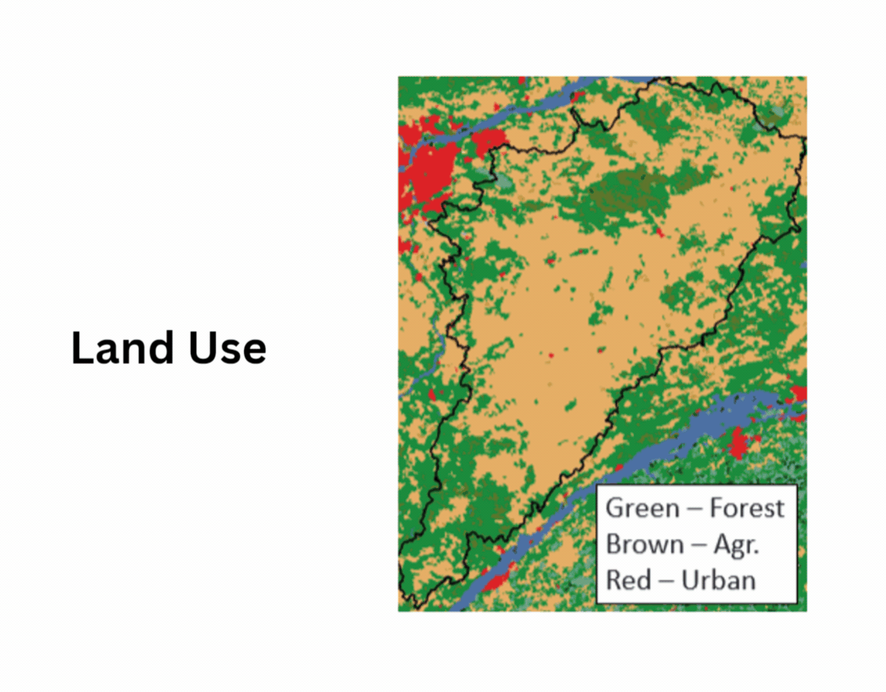
• Urban and agricultural conditions represented.
• Real-time weather radar, remote sensing products, satellite imagery, and more.

Analyze Hydrologic Systems In Real-time

Depth to groundwater forecast powered by HGSRT.
Understand how your current watershed conditions relate to the past and visualize how your watershed will respond dynamically to changing weather patterns.
-
• 7-day and 32-day forecast modes
• Visualize flood and drought impacts
• Responsive web application
In a changing world with escalating climate stress, HGSRT stands as a sophisticated solution to support all stakeholders facing water resources challenges.
Features

Streamflow
Streamflow forecasts at real and virtual gauging stations; user defined alerts provide advanced warning of flood.

Groundwater
Field-scale mapping of forecasted soil saturation, depth-to-groundwater, exfiltration, and recharge.
Satellite Imagery
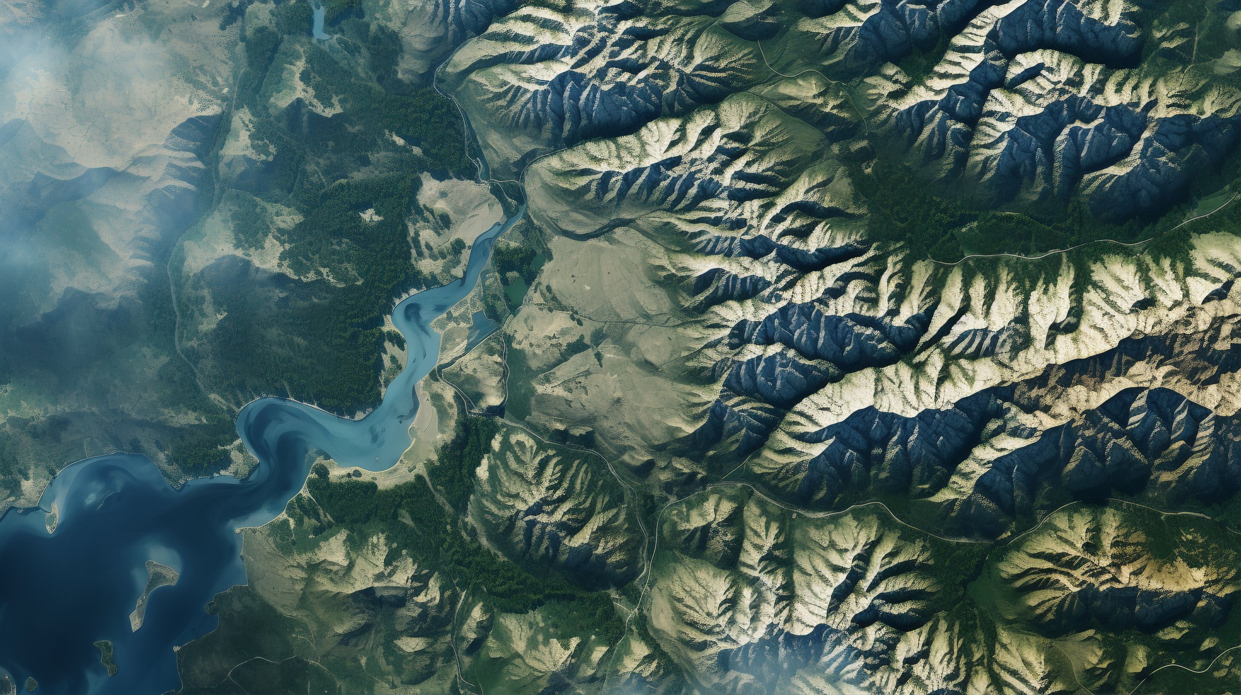
Combine satellite imagery, remote sensing and static maps for a holistic representation of current conditions.

Probabilistic
Forecasting framework based on an ensemble of weather forecasts, shows you the best- and worst-case scenarios.
Integrate with your existing forecasting systems

Groundwater exfiltration forecasting, essential to maintain baseflow to steams under drought conditions.
Enhance your existing flood and drought prediction systems by exporting HGSRT data in several standard data formats.
-
• HEC RAS DSS
• Open Geospatial Consortium compliant JSON
• Spreadsheets
• Wiski ZRXP
• NetCDF-UGRID, for Delft-FEWS and QGIS

Interact with near-real-time data seamlessly

The HGSRT Process.
Contextualize your forecasts by comparing them to time series of observational data. HGSRT is upfront about performance, and can calculate predictive skill at any station that has gauging data.
-
• Connected to Water Survey of Canada and USGS stations
• Can connect to any Wiski database
• Custom data imports available on request
Forecast Specifications
7-day or 32-day forecast lead times
18-hour and 6-month forecasts also available
Fully automated
Daily or weekly forecast launches
Deterministic or probabilistic
Initialization based on continuous spin-up or assimilation of observational data
Groundwater and surface water outputs
Timeseries and raster formats
Alerting of extreme events by email
Advanced weather and snow data processing
Export to standard output formats
Support for desktop and mobile devices
The HGSRT Process
01
Construct a HydroGeoSphere Model of Your Site
Establish the geographical area where you’d like to perform near-real-time forecasting, and work with us to build a custom HydroGeoSphere model. Models typically range from site scale (<1 km²) at high resolution to coarsely resolved basins over 150,000km²).
The HGSRT Advantage
A physics-based approach is known to produce more accurate simulations even in regions with very little/sparse observational & borehole data. A custom-tailored model will resolve the features you care about and deliver insights your stakeholders need.

02
Spin Up Your Model To Real-Time
Aquanty staff will spin your model up to near-real time conditions using meteorological (re)analysis data and short-term weather forecasts.
The HGSRT Advantage
Aquanty’s advanced weather and snow data processing pipelines mean your model will be marched forward in time with the best possible boundary flux data.
03
Gathers Real-time Data
HGSRT is connected to a wide range of data feeds, and more feeds can be added to the system. Data can be integrated from any available streamflow, groundwater, and soil moisture sensors.
The HGSRT Advantage
Near-real-time data feeds allow HGSRT to perform initialization, bias correction, predictive skill analysis, and to help provide context about changing conditions. Do you use Wiski, WSC, or USGS? We are already connected.

04
Forecast Initialization
HGSRT’s advanced forecasting pipeline will trigger forecasts at regular intervals. Forecast initial conditions are selected automatically based on observational data or from a continuous model spin-up that updates daily.
The HGSRT Advantage
HGSRT uses a patent-pending forecasting procedure. Complex data processing tasks are all abstracted away from the user for ease of use, and results are uploaded to the cloud for secure data dissemination.

05
Automated Forecast Orchestration
Hydrological forecasts are driven by liquid precipitation + snowmelt and potential evapotranspiration maps derived from a meteorological forecast. Postprocessing routines upload streamflow rates, water levels, and soil saturation predictions to the cloud.
The HGSRT Advantage
Weather forecast uncertainty is a major source of hydrological forecast uncertainty. By forcing the models with an ensemble of weather forecasts, the user can see a spread of possible conditions 7 to 32 days out.

06
Visualize Results on Any Device
Use your desktop PC or mobile device to visualize forecasts using our advanced web map and time series charts. Export results for processing, or connect to HGSRT’s APIs. Securely lock down access to your own set of expert users.
The HGSRT Advantage
Integrated GW-SW models generate big data, but HGSRT’s web application is fast, modern, and responsive. Exported HGSRT forecasts can integrate seamlessly with your current computer systems.
Contact our Team to Schedule a Demo and Start Using HGS Real-Time (HGSRT)